
Mostar topographic map
Interactive map
Click on the map to display elevation.
About this map
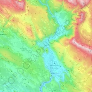
Name: Mostar topographic map, elevation, terrain.
Average elevation: 1,975 ft
Minimum elevation: 62 ft
Maximum elevation: 6,289 ft
Other topographic maps
Click on a map to view its topography, its elevation and its terrain.
Mostar
Bosnia and Herzegovina > Federation of Bosnia and Herzegovina > City of Mostar
Mostar, Local community Centar II, City of Mostar, Herzegovina-Neretva Canton, Federation of Bosnia and Herzegovina, Bosnia and Herzegovina
Average elevation: 725 ft