
Santa María Zacatepec topographic map
Interactive map
Click on the map to display elevation.
About this map
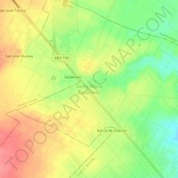
Name: Santa María Zacatepec topographic map, elevation, terrain.
Location: Santa María Zacatepec, Juan C. Bonilla, Puebla, México (19.10333 -98.38528 19.14333 -98.34528)
Average elevation: 7,287 ft
Minimum elevation: 7,159 ft
Maximum elevation: 7,395 ft
Other topographic maps
Click on a map to view its topography, its elevation and its terrain.
Cuanalá
México > Puebla > Juan C. Bonilla
Cuanalá, Juan C. Bonilla, Puebla, 72766, México
Average elevation: 7,172 ft