
Saint Ignace topographic map
Interactive map
Click on the map to display elevation.
About this map
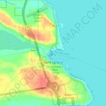
Name: Saint Ignace topographic map, elevation, terrain.
Location: Saint Ignace, Mackinac County, Michigan, United States (45.84858 -84.74219 45.89715 -84.70093)
Average elevation: 620 ft
Minimum elevation: 568 ft
Maximum elevation: 732 ft
Other topographic maps
Click on a map to view its topography, its elevation and its terrain.
Mackinac Island
United States > Michigan > Mackinac County
Mackinac Island, Mackinac County, Michigan, 49757, United States
Average elevation: 600 ft
Bois Blanc Township
United States > Michigan > Mackinac County
Bois Blanc Township, Mackinac County, Michigan, 49775, United States
Average elevation: 587 ft
Crossville Lake
United States > Michigan > Mackinac County
Crossville Lake, Hendricks Township, Mackinac County, Michigan, United States
Average elevation: 863 ft