
Faversham topographic map
Interactive map
Click on the map to display elevation.
About this map
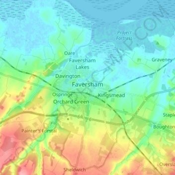
Name: Faversham topographic map, elevation, terrain.
Location: Faversham, Kent, South East, England, ME13 8NU, United Kingdom (51.27441 0.85119 51.35441 0.93119)
Average elevation: 85 ft
Minimum elevation: -10 ft
Maximum elevation: 302 ft