
Larissa topographic map
Interactive map
Click on the map to display elevation.
About this map
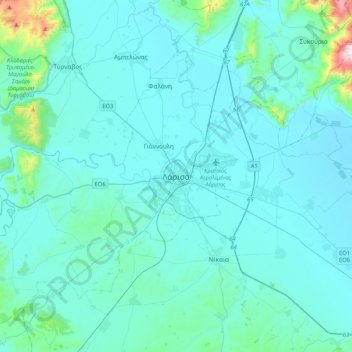
Name: Larissa topographic map, elevation, terrain.
Average elevation: 420 ft
Minimum elevation: 154 ft
Maximum elevation: 3,520 ft
Other topographic maps
Click on a map to view its topography, its elevation and its terrain.
Glafki
Greece > Thessaly and Central Greece > Larisa Regional Unit > Municipal Unit of Platykampos
Glafki, Municipal Unit of Platykampos, Kileler Municipality, Larisa Regional Unit, Thessaly, Thessaly and Central Greece, 415 00, Greece
Average elevation: 197 ft
Όλυμπος
Greece > Thessaly and Central Greece > Larisa Regional Unit > Elassona Municipality
Όλυμπος, Elassona Municipality, Larisa Regional Unit, Thessaly, Thessaly and Central Greece, Greece
Average elevation: 8,058 ft