
Neora Valley National Park topographic map
Interactive map
Click on the map to display elevation.
About this map
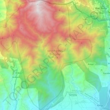
Name: Neora Valley National Park topographic map, elevation, terrain.
Average elevation: 4,295 ft
Minimum elevation: 860 ft
Maximum elevation: 10,299 ft