Geolocate

Kugong Island topographic map

Interactive map

Click on the map to display elevation.

About this map

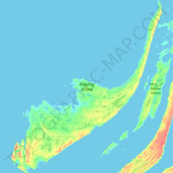
Name: Kugong Island topographic map, elevation, terrain.

Location: Kugong Island, NU, Canada (56.17090 -80.10864 56.53969 -79.52593)

Average elevation: 16 ft

Minimum elevation: -10 ft

Maximum elevation: 194 ft

Other topographic maps

Click on a map to view its topography, its elevation and its terrain.

NU

Canada > NU

NU, Canada

Average elevation: 3 ft

North Twin Island

Canada > NU

North Twin Island, NU, Canada

Average elevation: 33 ft

Innetalling Island

Canada > NU

Innetalling Island, NU, Canada

Average elevation: 10 ft

Tukarak Island

Canada > NU

Tukarak Island, NU, Canada

Average elevation: 46 ft

Mavor Island

Canada > NU

Mavor Island, NU, Canada

Average elevation: 20 ft