
Herschdorf topographic map
Interactive map
Click on the map to display elevation.
About this map
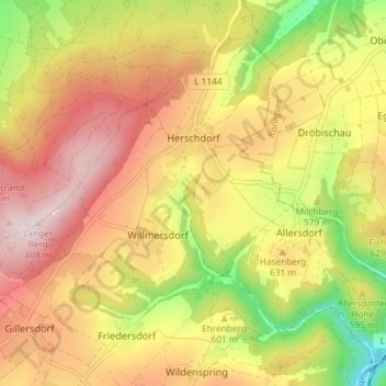
Name: Herschdorf topographic map, elevation, terrain.
Location: Herschdorf, Großbreitenbach, Ilm-Kreis, Thüringen, Duitsland (50.60115 11.01649 50.64367 11.09045)
Average elevation: 2,011 ft
Minimum elevation: 1,227 ft
Maximum elevation: 2,631 ft