
Ukerewe topographic map
Interactive map
Click on the map to display elevation.
About this map
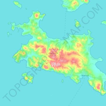
Name: Ukerewe topographic map, elevation, terrain.
Location: Ukerewe, Mwanza Region, Lake Zone, Tanzania (-2.17763 32.82023 -1.88532 33.18584)
Average elevation: 3,776 ft
Minimum elevation: 3,711 ft
Maximum elevation: 4,334 ft
Other topographic maps
Click on a map to view its topography, its elevation and its terrain.