
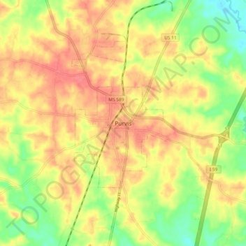
Purvis topographic map
Interactive map
Click on the map to display elevation.
About this map
Name: Purvis topographic map, elevation, terrain.
Location: Purvis, Lamar County, Mississippi, 39475, United States (31.10434 -89.44696 31.18434 -89.36696)
Average elevation: 322 ft
Minimum elevation: 203 ft
Maximum elevation: 407 ft