
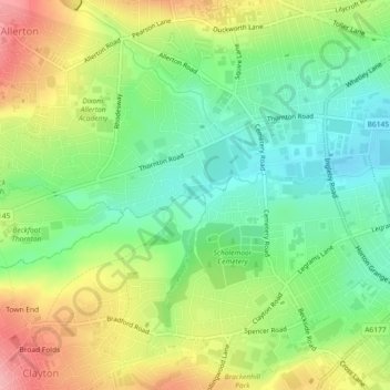
Middle Brook topographic map
Interactive map
Click on the map to display elevation.
About this map
Name: Middle Brook topographic map, elevation, terrain.
Average elevation: 558 ft
Minimum elevation: 390 ft
Maximum elevation: 797 ft
Other topographic maps
Click on a map to view its topography, its elevation and its terrain.
Ilkley
United Kingdom > England > Bradford
Ilkley, Bradford, West Yorkshire, England, United Kingdom
Average elevation: 725 ft
Bingley
United Kingdom > England > Bradford
Bingley, Bradford, West Yorkshire, England, United Kingdom
Average elevation: 650 ft
Baildon
United Kingdom > England > Bradford > Baildon
Baildon, Bradford, West Yorkshire, England, United Kingdom
Average elevation: 482 ft
Steeton with Eastburn
United Kingdom > England > Bradford
Steeton with Eastburn, Bradford, Yorkshire and the Humber, England, United Kingdom
Average elevation: 597 ft