
Storm Lake topographic map
Interactive map
Click on the map to display elevation.
About this map
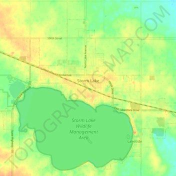
Name: Storm Lake topographic map, elevation, terrain.
Location: Storm Lake, Buena Vista County, Iowa, 50588, United States (42.61527 -95.24550 42.66921 -95.15163)
Average elevation: 1,411 ft
Minimum elevation: 1,352 ft
Maximum elevation: 1,470 ft
Other topographic maps
Click on a map to view its topography, its elevation and its terrain.
Lakeside
United States > Iowa > Buena Vista County
Lakeside, Buena Vista County, Iowa, United States
Average elevation: 1,401 ft