
Brussels topographic map
Interactive map
Click on the map to display elevation.
About this map
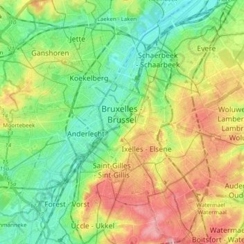
Name: Brussels topographic map, elevation, terrain.
Location: Brussels, City of Brussels, Brussels-Capital, Belgium (50.79641 4.33558 50.89050 4.40201)
Average elevation: 184 ft
Minimum elevation: 33 ft
Maximum elevation: 397 ft