
Unity Lake topographic map
Interactive map
Click on the map to display elevation.
About this map
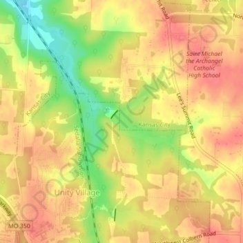
Name: Unity Lake topographic map, elevation, terrain.
Average elevation: 928 ft
Minimum elevation: 791 ft
Maximum elevation: 1,001 ft
Other topographic maps
Click on a map to view its topography, its elevation and its terrain.
WHB-AM (Kansas City)
USA > Missouri > Kansas City
WHB-AM (Kansas City), North Eastern Road, Kansas City, Clay County, Missouri, 64166, USA
Average elevation: 1,024 ft