
Emi Koussi topographic map
Interactive map
Click on the map to display elevation.
About this map
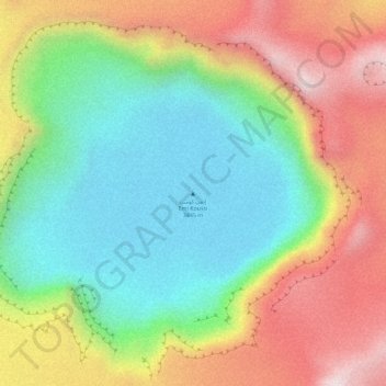
Name: Emi Koussi topographic map, elevation, terrain.
Location: Emi Koussi, Tibesti, Chad (19.83259 18.56085 19.83269 18.56095)
Average elevation: 9,528 ft
Minimum elevation: 8,747 ft
Maximum elevation: 10,509 ft
Emi Koussi (also known as Emi Koussou) is a high pyroclastic shield volcano that lies at the southeast end of the Tibesti Mountains in the central Sahara, in the northern Borkou Region of northern Chad. The highest mountain of the Sahara, the volcano is one of several in the Tibesti range, and reaches an elevation of 3,415 metres (11,204 ft), rising 3 km (1.9 mi) above the surrounding sandstone plains. The volcano is 60–70 kilometres (37–43 mi) wide and has a volume of 2,500 cubic kilometres (600 cu mi).
Other topographic maps
Click on a map to view its topography, its elevation and its terrain.