
Swiss topographic map
Interactive map
Click on the map to display elevation.
About this map
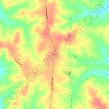
Name: Swiss topographic map, elevation, terrain.
Location: Swiss, Gasconade County, Missouri, USA (38.54282 -91.49127 38.58282 -91.45127)
Average elevation: 837 ft
Minimum elevation: 709 ft
Maximum elevation: 932 ft