
Cutts Island topographic map
Interactive map
Click on the map to display elevation.
About this map
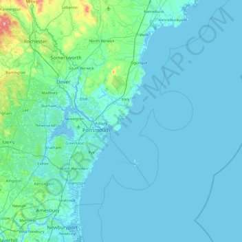
Name: Cutts Island topographic map, elevation, terrain.
Location: Cutts Island, Kittery, York County, Maine, 03905, USA (42.77342 -70.98422 43.41342 -70.34422)
Average elevation: 79 ft
Minimum elevation: -26 ft
Maximum elevation: 1,158 ft