
Dublin topographic map
Interactive map
Click on the map to display elevation.
About this map
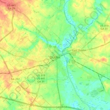
Name: Dublin topographic map, elevation, terrain.
Location: Dublin, Laurens County, Georgia, United States (32.48190 -82.98510 32.60364 -82.87507)
Average elevation: 233 ft
Minimum elevation: 144 ft
Maximum elevation: 364 ft
Other topographic maps
Click on a map to view its topography, its elevation and its terrain.
Cadwell
United States > Georgia > Laurens County
Cadwell, Laurens County, Georgia, United States
Average elevation: 348 ft