
Santa Maria topographic map
Interactive map
Click on the map to display elevation.
About this map
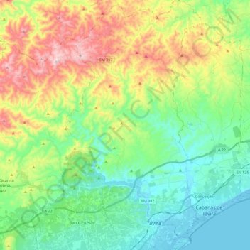
Name: Santa Maria topographic map, elevation, terrain.
Location: Santa Maria, Tavira, TVR, Faro, Algarve, Portugal (37.10653 -7.73004 37.28783 -7.60608)
Average elevation: 554 ft
Minimum elevation: -3 ft
Maximum elevation: 1,690 ft