
Bad Wildbad topographic map
Interactive map
Click on the map to display elevation.
About this map
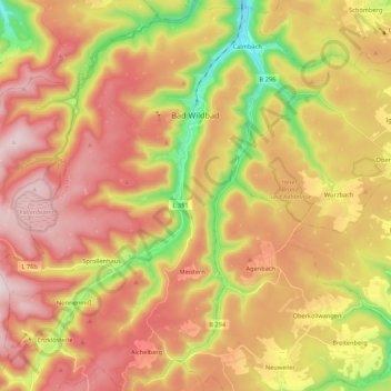
Name: Bad Wildbad topographic map, elevation, terrain.
Average elevation: 2,257 ft
Minimum elevation: 1,234 ft
Maximum elevation: 3,104 ft
Other topographic maps
Click on a map to view its topography, its elevation and its terrain.
Wildberg
Germany > Baden-Württemberg > Landkreis Calw > Wildberg
Wildberg, Landkreis Calw, Baden-Württemberg, 72218, Germany
Average elevation: 1,745 ft