
Heers topographic map
Interactive map
Click on the map to display elevation.
About this map
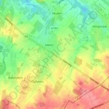
Name: Heers topographic map, elevation, terrain.
Location: Heers, Tongeren, Limburg, Flanders, Belgium (50.72825 5.27119 50.76619 5.33860)
Average elevation: 305 ft
Minimum elevation: 190 ft
Maximum elevation: 436 ft