
Florenville topographic map
Interactive map
Click on the map to display elevation.
About this map
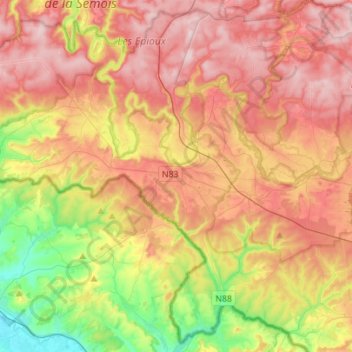
Name: Florenville topographic map, elevation, terrain.
Location: Florenville, Virton, Luxembourg, Wallonia, Belgium (49.61078 5.14709 49.78127 5.42495)
Average elevation: 1,037 ft
Minimum elevation: 525 ft
Maximum elevation: 1,483 ft
Other topographic maps
Click on a map to view its topography, its elevation and its terrain.
Ethe
Belgium > Luxembourg > Virton > Virton
Ethe, Virton, Luxembourg, Wallonia, Belgium
Average elevation: 961 ft
Saint-Mard
Belgium > Luxembourg > Virton > Virton
Saint-Mard, Virton, Luxembourg, Wallonia, 6762, Belgium
Average elevation: 892 ft
Habay
Belgium > Luxembourg > Virton
Habay, Virton, Luxembourg, Wallonia, Belgium
Average elevation: 1,299 ft