
Umaji topographic map
Interactive map
Click on the map to display elevation.
About this map
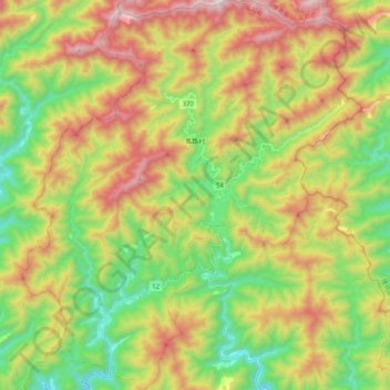
Name: Umaji topographic map, elevation, terrain.
Location: Umaji, Aki County, Kochi Prefecture, Japan (33.52689 134.00693 33.69606 134.18417)
Average elevation: 2,260 ft
Minimum elevation: 574 ft
Maximum elevation: 4,596 ft