
Col d'Ibañeta topographic map
Interactive map
Click on the map to display elevation.
About this map
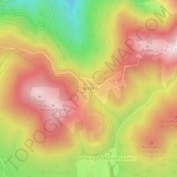
Name: Col d'Ibañeta topographic map, elevation, terrain.
Average elevation: 3,383 ft
Minimum elevation: 2,208 ft
Maximum elevation: 4,252 ft
Other topographic maps
Click on a map to view its topography, its elevation and its terrain.
Bataille de Roncevaux (778) (aprox.)
Espagne > Navarre > Pirinioak / Pirineo > Roncevaux
Bataille de Roncevaux (778) (aprox.), Iruña - Frantzia (Luzaide) errepidea / Carretera Pamplona - Francia (Valcarlos), Orreaga, Roncevaux, Pirinioak / Pirineo, Navarre, 31650, Espagne
Average elevation: 3,389 ft