
Pļaviņas topographic map
Interactive map
Click on the map to display elevation.
About this map
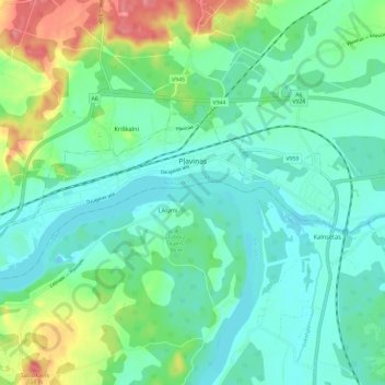
Name: Pļaviņas topographic map, elevation, terrain.
Location: Pļaviņas, Aizkraukles novads, LV-5120, Latvia (56.59909 25.66625 56.62867 25.78423)
Average elevation: 302 ft
Minimum elevation: 226 ft
Maximum elevation: 512 ft
Other topographic maps
Click on a map to view its topography, its elevation and its terrain.