
سكرة topographic map
Interactive map
Click on the map to display elevation.
About this map
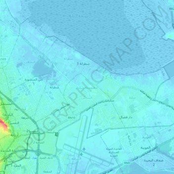
Name: سكرة topographic map, elevation, terrain.
Location: سكرة, Ariana, Tunisia (36.84855 10.18550 36.91383 10.28864)
Average elevation: 10 ft
Minimum elevation: -26 ft
Maximum elevation: 184 ft
Other topographic maps
Click on a map to view its topography, its elevation and its terrain.