
Loxton North topographic map
Interactive map
Click on the map to display elevation.
About this map
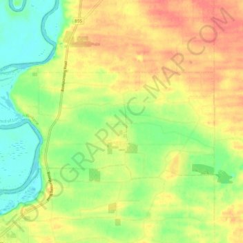
Name: Loxton North topographic map, elevation, terrain.
Average elevation: 121 ft
Minimum elevation: 30 ft
Maximum elevation: 207 ft
Other topographic maps
Click on a map to view its topography, its elevation and its terrain.
Bookpurnong
Australia > South Australia > The District Council of Loxton Waikerie
Bookpurnong, The District Council of Loxton Waikerie, South Australia, 5333, Australia
Average elevation: 121 ft
Ramco
Australia > South Australia > The District Council of Loxton Waikerie
Ramco, The District Council of Loxton Waikerie, South Australia, 5322, Australia
Average elevation: 95 ft
Loxton
Australia > South Australia > The District Council of Loxton Waikerie > Loxton
Loxton, The District Council of Loxton Waikerie, South Australia, 5333, Australia
Average elevation: 121 ft