
Portadown topographic map
Interactive map
Click on the map to display elevation.
About this map
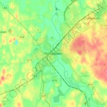
Name: Portadown topographic map, elevation, terrain.
Average elevation: 92 ft
Minimum elevation: 3 ft
Maximum elevation: 220 ft
Other topographic maps
Click on a map to view its topography, its elevation and its terrain.
Loughgall
United Kingdom > Northern Ireland > County Armagh
Loughgall, County Armagh, Ulster, Northern Ireland, BT61 8HY, United Kingdom
Average elevation: 105 ft
Armagh
United Kingdom > Northern Ireland > County Armagh > Armagh
Armagh, County Armagh, Ulster, Northern Ireland, United Kingdom
Average elevation: 328 ft
Lurgan
United Kingdom > Northern Ireland > County Armagh > Lurgan
Lurgan, County Armagh, Northern Ireland, United Kingdom
Average elevation: 157 ft