
Yacuanquer topographic map
Interactive map
Click on the map to display elevation.
About this map
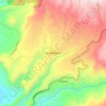
Name: Yacuanquer topographic map, elevation, terrain.
Location: Yacuanquer, Nariño, Colombia (1.07588 -77.44176 1.15588 -77.36176)
Average elevation: 8,606 ft
Minimum elevation: 6,325 ft
Maximum elevation: 10,932 ft