
Buram topographic map
Interactive map
Click on the map to display elevation.
About this map
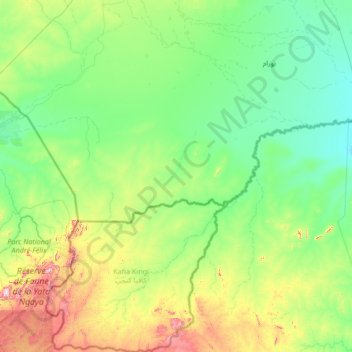
Name: Buram topographic map, elevation, terrain.
Location: Buram, South Darfur State, Sudan (8.68528 23.44778 11.33099 25.84902)
Average elevation: 1,886 ft
Minimum elevation: 1,457 ft
Maximum elevation: 4,439 ft
Other topographic maps
Click on a map to view its topography, its elevation and its terrain.
El Fifi
Sudan > South Darfur State > Buram
El Fifi, Buram, South Darfur State, Sudan
Average elevation: 1,598 ft