
Mersch topographic map
Interactive map
Click on the map to display elevation.
About this map
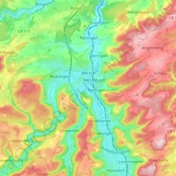
Name: Mersch topographic map, elevation, terrain.
Location: Mersch, Canton Mersch, Luxembourg (49.69306 6.03732 49.79127 6.15897)
Average elevation: 1,020 ft
Minimum elevation: 692 ft
Maximum elevation: 1,437 ft