
Schengen topographic map
Interactive map
Click on the map to display elevation.
About this map
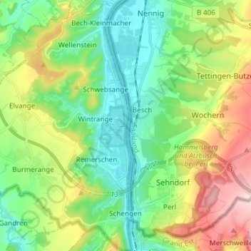
Name: Schengen topographic map, elevation, terrain.
Location: Schengen, Canton Remich, Luxembourg (49.45951 6.28439 49.53886 6.36885)
Average elevation: 764 ft
Minimum elevation: 446 ft
Maximum elevation: 1,398 ft
Other topographic maps
Click on a map to view its topography, its elevation and its terrain.
Brill
Luxembourg > Canton Remich > Altwies
Brill, Altwies, Mondorf-les-Bains, Canton Remich, 5611, Luxembourg
Average elevation: 751 ft