
Tanguièta topographic map
Interactive map
Click on the map to display elevation.
About this map
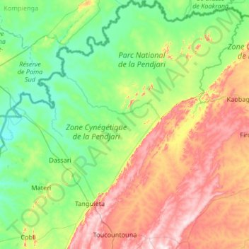
Name: Tanguièta topographic map, elevation, terrain.
Location: Tanguièta, Atakora Department, Benin (10.43872 1.04963 11.48107 1.97841)
Average elevation: 883 ft
Minimum elevation: 446 ft
Maximum elevation: 2,011 ft
Other topographic maps
Click on a map to view its topography, its elevation and its terrain.
Tanguieta
Benin > Atakora Department > Tanguièta
Tanguieta, Tanguièta, Atakora Department, Benin
Average elevation: 961 ft