
Ícolo and Bengo Municipality topographic map
Interactive map
Click on the map to display elevation.
About this map
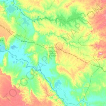
Name: Ícolo and Bengo Municipality topographic map, elevation, terrain.
Location: Ícolo and Bengo Municipality, Bengo, Angola (-9.53996 13.47932 -8.84215 14.20395)
Average elevation: 292 ft
Minimum elevation: -3 ft
Maximum elevation: 1,047 ft