
Lake Ohrid topographic map
Interactive map
Click on the map to display elevation.
About this map
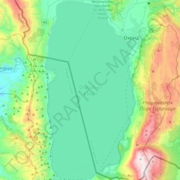
Name: Lake Ohrid topographic map, elevation, terrain.
Average elevation: 3,146 ft
Minimum elevation: 1,791 ft
Maximum elevation: 7,408 ft
Other topographic maps
Click on a map to view its topography, its elevation and its terrain.
Стогово
Macedonia > Southwestern Region > Broshtica
Стогово, Broshtica, Municipality of Centar Zhupa, Southwestern Region, Macedonia
Average elevation: 6,175 ft
Jablanica
Macedonia > Southwestern Region > Jablanica
Jablanica, Municipality of Struga, Southwestern Region, Macedonia
Average elevation: 4,039 ft
Debar
Macedonia > Southwestern Region > Debar
Debar, Municipality of Debar, Southwestern Region, 1250, Macedonia
Average elevation: 2,379 ft