
Piton de la Fournaise topographic map
Interactive map
Click on the map to display elevation.
About this map
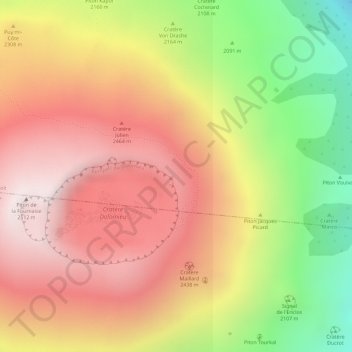
Name: Piton de la Fournaise topographic map, elevation, terrain.
Average elevation: 7,398 ft
Minimum elevation: 5,623 ft
Maximum elevation: 8,593 ft
Other topographic maps
Click on a map to view its topography, its elevation and its terrain.
Bois-Blanc
France > Réunion > Sainte-Rose
Bois-Blanc, Sainte-Rose, Saint-Benoît, Réunion, 97439, France
Average elevation: 522 ft