
Cang topographic map
Interactive map
Click on the map to display elevation.
About this map
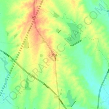
Name: Cang topographic map, elevation, terrain.
Location: Cang, Dingyuan County, Chuzhou City, Anhui, PRC (32.36743 117.71520 32.44743 117.79520)
Average elevation: 180 ft
Minimum elevation: 108 ft
Maximum elevation: 266 ft