
Bull Hill topographic map
Interactive map
Click on the map to display elevation.
About this map
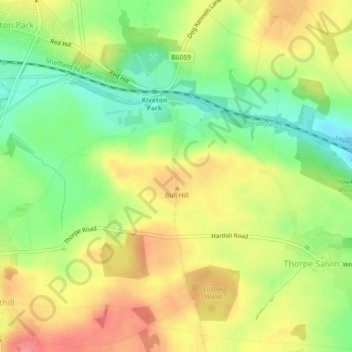
Name: Bull Hill topographic map, elevation, terrain.
Average elevation: 364 ft
Minimum elevation: 246 ft
Maximum elevation: 476 ft
Other topographic maps
Click on a map to view its topography, its elevation and its terrain.
Thrybergh
United Kingdom > England > Rotherham
Thrybergh, Rotherham, South Yorkshire, England, United Kingdom
Average elevation: 157 ft