
Deir Ez Zor topographic map
Interactive map
Click on the map to display elevation.
About this map
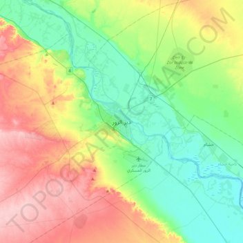
Name: Deir Ez Zor topographic map, elevation, terrain.
Average elevation: 797 ft
Minimum elevation: 627 ft
Maximum elevation: 1,083 ft
From 10 April 2016 to 31 August 2017, the World Food Programme supplied the city with food and essential relief items through a high-altitude airdrop service. With a Russian contracted Il-76 aircraft and parachute systems provided by Canada, the USA, and Russia, a total of 8015 pallets with an average weight of 754 kg were dropped into the besieged city of Deir-Ez-Zor. Three hundred nine flights were performed during the operational period.
Other topographic maps
Click on a map to view its topography, its elevation and its terrain.
Deir Ez-Zor District
Syria > Deir Ezzor Governorate
Deir Ez-Zor District, Deir Ezzor Governorate, Syria
Average elevation: 1,066 ft