
Camp Douglas topographic map
Interactive map
Click on the map to display elevation.
About this map
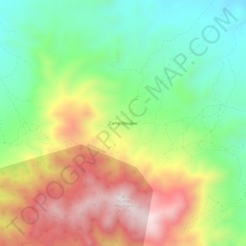
Name: Camp Douglas topographic map, elevation, terrain.
Location: Camp Douglas, Mineral County, Nevada, USA (38.31854 -118.21984 38.35854 -118.17984)
Average elevation: 6,598 ft
Minimum elevation: 5,581 ft
Maximum elevation: 7,979 ft