
Santa Fé topographic map
Interactive map
Click on the map to display elevation.
About this map
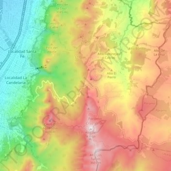
Name: Santa Fé topographic map, elevation, terrain.
Location: Santa Fé, Bogota, Bogota Capital District, Colombia (4.55876 -74.08901 4.62881 -73.99742)
Average elevation: 10,167 ft
Minimum elevation: 8,383 ft
Maximum elevation: 12,018 ft