
Beira topographic map
Interactive map
Click on the map to display elevation.
About this map
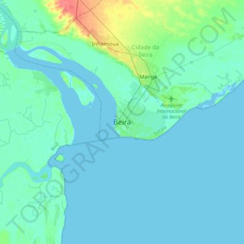
Name: Beira topographic map, elevation, terrain.
Location: Beira, Cidade da Beira, Sofala Province, 2100, Mozambique (-19.98871 34.68178 -19.66871 35.00178)
Average elevation: 16 ft
Minimum elevation: -3 ft
Maximum elevation: 138 ft
Other topographic maps
Click on a map to view its topography, its elevation and its terrain.
Gorongosa
Gorongosa, Sofala Province, Mozambique
Average elevation: 899 ft