
Porrera topographic map
Interactive map
Click on the map to display elevation.
About this map
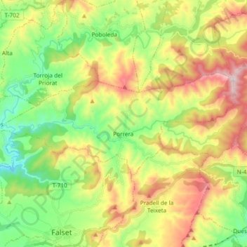
Name: Porrera topographic map, elevation, terrain.
Location: Porrera, Priorat, Tarragona, Catalonia, 43739, Spain (41.17088 0.77689 41.21634 0.92284)
Average elevation: 1,463 ft
Minimum elevation: 466 ft
Maximum elevation: 2,933 ft
Other topographic maps
Click on a map to view its topography, its elevation and its terrain.