
Casco topographic map
Interactive map
Click on the map to display elevation.
About this map
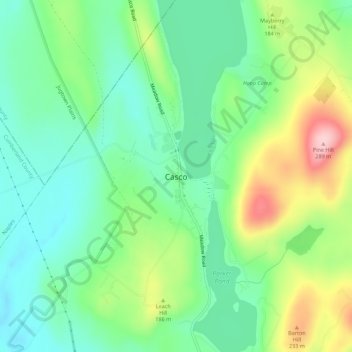
Name: Casco topographic map, elevation, terrain.
Location: Casco, Cumberland County, Maine, 04015, United States (43.98665 -70.54330 44.02665 -70.50330)
Average elevation: 505 ft
Minimum elevation: 285 ft
Maximum elevation: 948 ft