
Arkhust topographic map
Interactive map
Click on the map to display elevation.
About this map
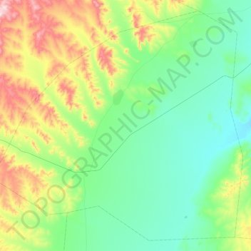
Name: Arkhust topographic map, elevation, terrain.
Location: Arkhust, Töv, Mongolia (47.33655 107.70426 47.62995 108.17816)
Average elevation: 4,813 ft
Minimum elevation: 4,321 ft
Maximum elevation: 6,152 ft
Other topographic maps
Click on a map to view its topography, its elevation and its terrain.