
Garwood topographic map
Interactive map
Click on the map to display elevation.
About this map
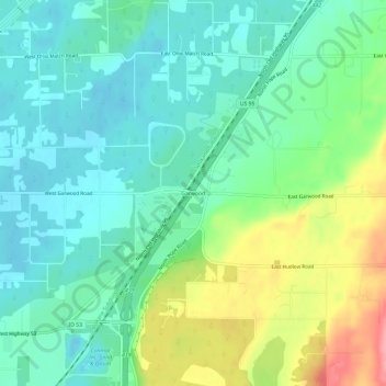
Name: Garwood topographic map, elevation, terrain.
Location: Garwood, Kootenai County, Idaho, 83835-9460, USA (47.81185 -116.79742 47.85185 -116.75742)
Average elevation: 2,349 ft
Minimum elevation: 2,247 ft
Maximum elevation: 2,585 ft