
Parker River topographic map
Interactive map
Click on the map to display elevation.
About this map
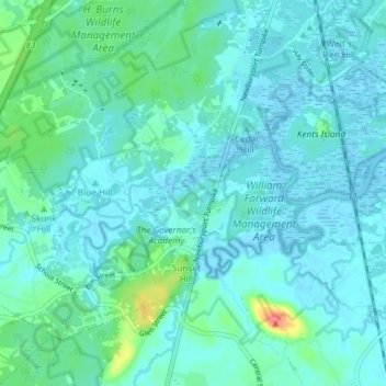
Name: Parker River topographic map, elevation, terrain.
Average elevation: 33 ft
Minimum elevation: -10 ft
Maximum elevation: 203 ft
Other topographic maps
Click on a map to view its topography, its elevation and its terrain.
North Shore Salt Marsh
USA > Massachusetts > Newbury
North Shore Salt Marsh, Pine Island Road, Newbury, Essex County, Massachusetts, 01951, USA
Average elevation: 10 ft