
White Meadow Lake topographic map
Interactive map
Click on the map to display elevation.
About this map
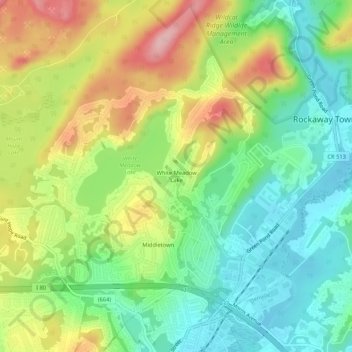
Name: White Meadow Lake topographic map, elevation, terrain.
Location: White Meadow Lake, Morris County, New Jersey, 07866, USA (40.90371 -74.53071 40.94371 -74.49071)
Average elevation: 738 ft
Minimum elevation: 509 ft
Maximum elevation: 1,089 ft