
Hugh Taylor Birch State Park topographic map
Interactive map
Click on the map to display elevation.
About this map
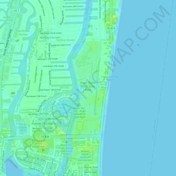
Name: Hugh Taylor Birch State Park topographic map, elevation, terrain.
Average elevation: 13 ft
Minimum elevation: -7 ft
Maximum elevation: 49 ft
Other topographic maps
Click on a map to view its topography, its elevation and its terrain.
Croissant Park
USA > Florida > Fort Lauderdale
Croissant Park, Fort Lauderdale, Broward County, Florida, USA
Average elevation: 23 ft