
Monte Carmelo topographic map
Interactive map
Click on the map to display elevation.
About this map
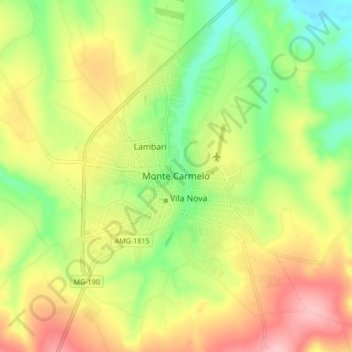
Name: Monte Carmelo topographic map, elevation, terrain.
Average elevation: 2,933 ft
Minimum elevation: 2,684 ft
Maximum elevation: 3,222 ft
The municipal seat is located at an elevation of 864 meters. The highest point in the municipality is Cabeceira Córrego Rancharia at 1,343 meters, while the lowest point is Foz Córrego Francos at 724 meters.